

FASTMA® brings attention to how modern Laser Land Leveler systems are evolving with GPS and auto-steer integration in field operations, reshaping precision land preparation methods.
Modern land preparation has moved beyond simple blade-based grading. The combination of laser control, GPS positioning, and auto-steer technology forms a coordinated system where terrain data, machine movement, and hydraulic response work together in real time. In this setup, a Land Leveler becomes part of a wider digital field management process rather than an isolated leveling tool.
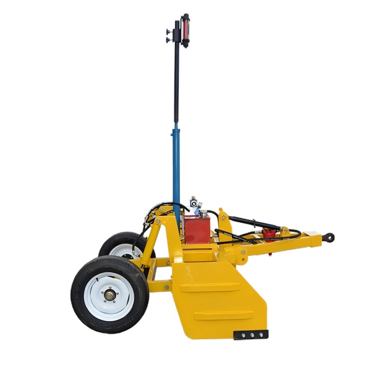
The laser transmitter establishes a consistent horizontal reference plane across the working field. A receiver mounted on the leveling equipment continuously detects elevation differences relative to this plane. Even slight variations in terrain height are converted into electrical signals, which are then processed by the controller.
The system responds instantly by adjusting the hydraulic cylinder controlling the blade position. This allows continuous correction while moving across uneven ground, reducing reliance on manual judgment and improving surface uniformity.
GPS technology introduces spatial awareness to the leveling process. Instead of treating the field as a uniform area, the system divides it into coordinate-based segments. Each segment records elevation data, allowing operators to identify high and low zones more precisely.
When GPS is integrated with Laser Land Leveler systems, it enables:
- Field boundary recognition
- Digital elevation mapping
- Route optimization for machinery movement
- Repeatable leveling patterns for future seasons
This combination is particularly useful in large-scale agricultural zones where terrain variation is complex and repetitive corrections are required.
Auto-steer systems guide machinery along pre-planned straight or curved paths. When connected to laser and GPS modules, steering accuracy and blade adjustment become synchronized. This reduces overlapping passes and ensures consistent soil distribution across the field.
Hydraulic systems act as the physical execution layer. Based on digital signals, they adjust blade height in milliseconds, maintaining balance between cutting and filling soil areas.
The operational process of a Land Leveler combined with GPS and auto-steer can be summarized in a continuous loop:
- The laser transmitter establishes a reference plane
- The receiver captures elevation differences in real time
- GPS defines machine position and movement path
- The controller processes both data streams
- Hydraulic system adjusts blade height instantly
- Auto-steer maintains correct travel direction
- The cycle repeats continuously during operation
This loop ensures that both positioning and leveling remain synchronized, even when field conditions change rapidly.
| Function Area | Traditional Method | Laser + GPS + Auto-Steer System |
| Field Guidance | Visual estimation | Satellite positioning |
| Level Accuracy | Operator-dependent | Sensor-controlled (±2cm range) |
| Movement Path | Manual steering | Auto-steered guidance |
| Soil Distribution | Inconsistent | Uniform and repeatable |
| Data Recording | None | Digital mapping available |
| Adjustment Speed | Slower response | Real-time hydraulic correction |
This comparison shows how integrated systems reduce variability and improve consistency in land shaping tasks.
In real-world applications, integrated leveling systems are used in several types of land preparation environments.
In newly reclaimed land, uneven terrain often contains unpredictable elevation differences. The Laser Land Leveler helps stabilize these surfaces for later planting stages.
In long-term cultivated fields, soil tends to develop micro-variations due to irrigation patterns and machinery traffic. GPS mapping helps identify these subtle changes, while laser correction restores uniformity.
In sloped areas being converted into terraces, auto-steer guidance ensures that machinery follows controlled paths while laser control maintains consistent step heights between levels.
The combined system introduces several operational improvements:
- Reduced dependency on visual judgment
- More stable field surface conditions
- Improved water distribution efficiency
- Lower repeated passes over the same area
However, field conditions can still influence performance. Dust accumulation on laser receivers, weak satellite signals in obstructed areas, and hydraulic lag under heavy load are common factors that require attention during operation. Proper calibration before use is essential to maintain stable performance.
Routine care plays a significant role in keeping integrated systems stable. Laser components require clean optical surfaces to maintain signal clarity. GPS modules depend on stable signal reception and periodic software calibration. Hydraulic systems require regular oil checks to ensure smooth response under continuous load.
A typical maintenance routine includes:
- Cleaning laser receiver lens surfaces
- Checking hydraulic oil levels and pressure stability
- Inspecting blade wear conditions
- Verifying GPS signal consistency before operation
- Lubricating moving mechanical joints
These steps help ensure that the Land Leveler continues to perform accurately across different field environments.
The increasing use of digital systems in agriculture reflects a broader shift toward data-supported land management. Instead of relying solely on manual observation, operators can now use combined sensor data to guide field shaping decisions.
This approach allows repeated use of recorded field data for future planning, making seasonal preparation more consistent. Over time, this reduces variability between planting cycles and supports more stable land conditions.
The integration of laser measurement, GPS mapping, and auto-steer coordination has transformed how land shaping tasks are performed in modern agriculture. A Laser Land Leveler operating within this system demonstrates how mechanical control and digital positioning can work together to improve field uniformity and operational consistency. In practical applications, Xingtai Farming First Agricultural Machinery Co., Ltd. contributes to this evolving approach through its FASTMA® Land Leveler series, reflecting the ongoing shift toward precision-based field preparation methods.


